Winter Overview and Trail Conditions:
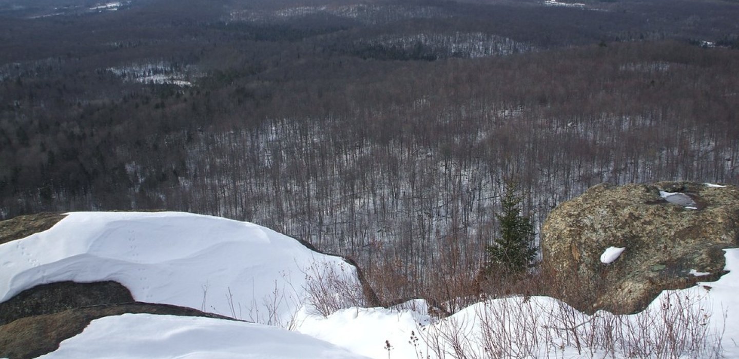
From the gate, start your snowshoe along a forest/logging road to this backcountry gem. The trail starts out following this road for quite some distance before reaching a foot trail. The road is quite easy but does gain some elevation. There is a split in the road part way in at around 1.25 miles, be sure to take the left here and continue to climb up a small knoll. Atop this knoll there is a clearing and the foot trail is on the left by a trail register. The foot-trail continues to climb through a very attractive forest, but never gets too steep. The summit is a partially open viewing platform with outstanding scenery out over the foothills. This summit can be very windy so be prepared for a wind chill.
Elevation:
1845 feet
Ascent:
460 Feet
Distance Round Trip:
4.9 miles
Approximate Time Round Trip:
Families with Kids: 4 to 5 hours
Experienced Snowshoers: 3 to 4hours
Out of Shape Snowshoers: 4 to 5 hours
Trailhead Location:
Leave Malone follow Route 30 south. Continue to the intersection of Route 30 and Route 458. Follow Route 458 North toward St. Regis Falls. Continue for just under 10-miles to the state trailhead on the right.
Difficulty: 1=easiest, 5=hardest
Two: this is an excellent beginner snowshoe destination to a small peak with great views, but does not get extensive winter use.
Additional Important Information:
The access road is not drivable, if the gate is open for some reason, do not drive it, as you might get locked in. This can be a very windy summit on occasion.