With the fall season settling in quite nicely and with the occasional spitting of the white stuff, I started having flashbacks of a hike I did in the fall of 2014, and I thought I would share. I have always had a bit of a fascination with the fire tower peaks and one day I just up and decided it could be a neat quest to hike even the ones that no longer have the steel structures. My eyes that day focused on the Meacham Lake quad map and Debar Mountain. For some reason I had never climbed this peak before. I always knew it was there, I guess the stars never aligned. This week was the week to go, and Corenne was on board as well for the drive and the hike. I think fact that the other peak I was talking about doing had the same name as her last might have interested her too.
Starting from Meacham Lake Campground
Upon arrival at the Meacham Lake Campground, which actually didn't take as long as we had anticipated -- the caffeine awakening might have helped with that -- we drove through the campground and found the dirt road leading to the trailhead. This long and narrow road, a bit rough, brought us to the trailhead and a decent sized parking area.

We layered up on this cold and windy day, painted in as much red gear for hunting season safety as we could gather, and headed up the trail. Our time along the initial 1.2 miles was exceptional even though the crisp morning air had us breathing deeply and exhaling puffs of hot clouds before us. The first part followed an old woods road, now used as a snowmobile trail, to the foot trail up Debar Mountain, so its flat groomed surface helped as well with our rapid walking. Once we started up the foot trail we were surprised at how wet it was. We expected most of the mud and water to be frozen enough to pounce over without much hesitation, but that was not the case. We needed to gear down. Beneath the thin layers of ice, which caught us off guard, was up to 4 inches of water.

The trail up Debar
The trail quickly led us on a moderate course to the Debar lean-to, which sits about three-quarters of a mile from the summit. We broke out the hot soup and gluten free crackers and decided to have an early lunch before we start the "real climb." Even though I had never been here before I was quite aware that we had not climbed much in elevation from the parking lot and there was much left to be accomplished. It most certainly had to be coming up soon. As the terrain became steeper, we put many feet of elevation behind us in a short amount of time and then we came to the base of a new slide, which looked to have eaten up the trail. It has now been slightly re-routed to avoid the pile of trees at the base. The climb along the slide was a bit steep, but not quite as steep as the section following. This section was covered in a thick layer of ice over steep rock lips. The ice was hard to the point where we had to walk carefully, even with our Microspikes on, to stay vertical.

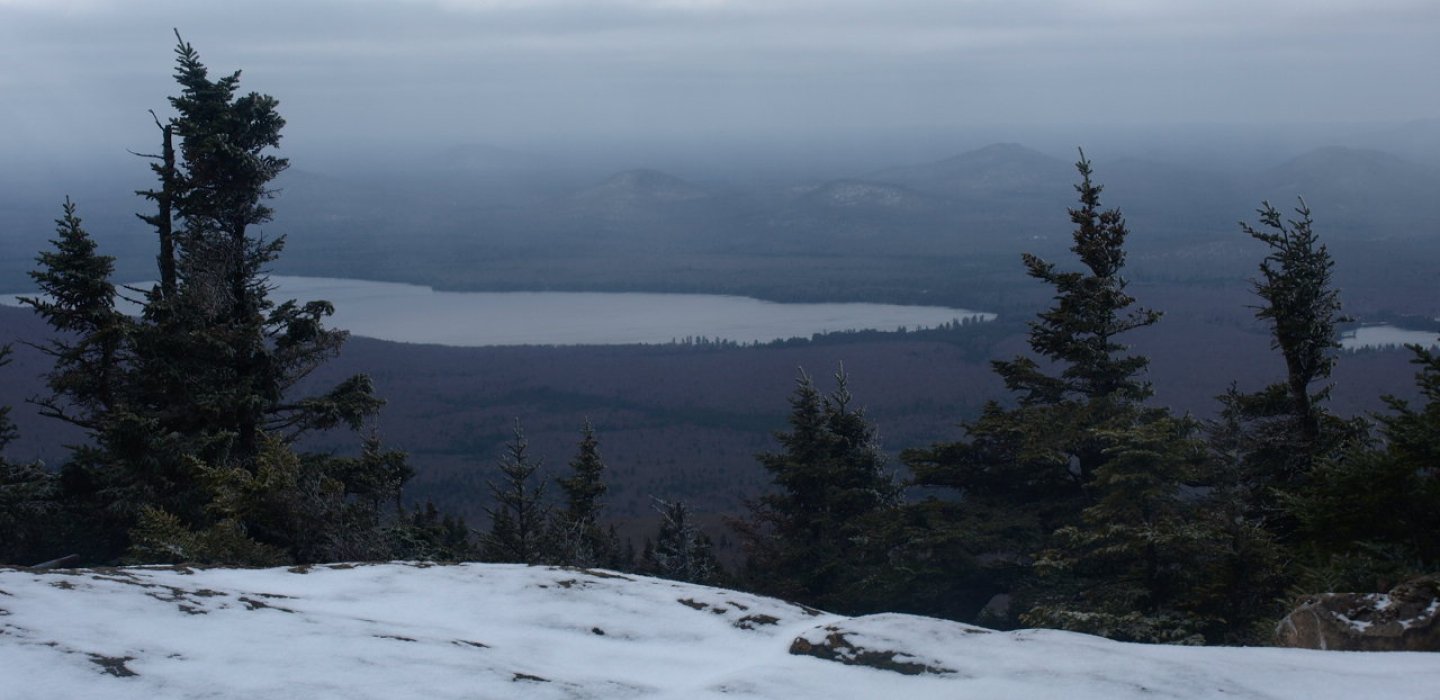
We summited soon after to a wonderful view, a bit surprising to both of us as we started in thick cloud cover. The rocky knob opened up most of the area around us, and we were amazed that we hadn't been there sooner. It was a great payoff. The frigid wind was biting our nose and cheeks and quickly moved us from our perch. We still hadn't packed up our face masks because we weren't used to the fact that the cold was coming.
It was off to Black Peak we went. Corenne wasn't convinced it was a good idea because it was a bit late in the day, but my assurance and persistence won her over. It didn't rest all that far off the trail so the detour shouldn't take all that long. After all, it was Black Peak and Corenne's last name is Black, how could we not go for a visit?

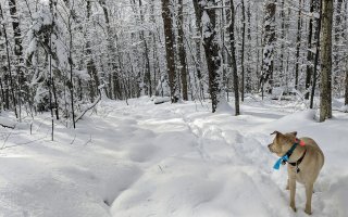
Black Peak and moose
Looking at the thick forest near the summit, we opted to descend the trail a ways and traverse over to the peak from lower ground. A direct route from the summit would have only paralleled the trail and that seemed pointless. Unfortunately for us, that meant we had to descend the steep, icy glades along the trail. After a couple of slips and butt slides, we hit the woods near about where it looked to be friendly terrain. With our GPS locked and loaded with the summit as our destination, we bushwhacked our way into the hardwood forest.

Soon we hit a cliff only a few hundred feet off the trail, which is not what we expected, but then again it's hard to expect anything accurately when you have never been there before. Good old Mother Nature is full of surprises. We zigzagged over small, grassed shelves and leaped off of a couple small, rocky lips and found ourselves in a nice shallow valley. It was a successful descent, I must say.

As we climbed out of the valley and over another small rise, we saw a couple dozen trees with rubbing on them. They had a similar look to a porcupine chew, but without teeth marks. We assumed it was a moose as the markings went 8 to 10 feet up the stem of the tree. In about 10 minutes our question would be answered -- it was moose. We didn't happen to see the animal, which would have been AWESOME, but the continuous piles of droppings left no question.

We summited Black Peak with expectations of a nice view, but the wooded summit offered little. At 2,700 feet in elevation it was a decent sized little mountain and fun to walk upon nonetheless. Our descent back to the trail brought me slightly off course to the right as I followed the easier terrain that was not infested with chin hobble. This required us to do a bit of traversing on a side slope, which is never fun. Eventually we rejoined the trail just a bit further than where the lean-to is. We required a brief break and a flat erratic seemed like the perfect spot. We finished off the Thermos of hot soup and we hauled tail back down the trail. We didn't even dance around the water and instead pushed through it, and back at the car we were. Now soaked from both the snow on the trees while bushwhacking and our playful walk through the water, we changed clothes almost in full. It was like sliding into cold sheets at the end of the day, but we didn't care. We just wanted to be dry and somewhat free of funk.
So have I "peaked" you interest in visiting some of the fire towers of the Adirondacks? Stop by a local bookstore and pick up a guidebook. Be sure to look into the Adirondack Fire Tower Challenge as your next adventure rolls around, and if you would like a guide here in Malone, we can set you up.

Comments
Add new comment