Unpublished
Place names in the Adirondack Park have always intrigued me and with that comes the love of Adirondack History, Legends, Lore, old tales, and at times some big fish stories. However, through a vast amount of exploring in the wilds, on the internet and in books, I have come to some conclusions on some local names and why they might be named as they are; not to mention some other neat tidbits.
Elephant Mountain
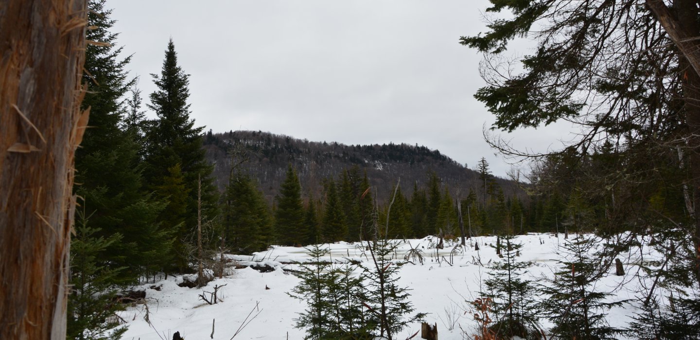
While not in the Adirondack Park, its name alone drew me to it and the wonder of it all. Where does a feature get the name Elephant from? Seems very much out of place and more at home on the plains of Africa than on State Land in Northern New York.

The best that can be made of this oddity is that Elephant is a reference to a shape, or the look of the mountain from a certain location at a certain angle. The name can also be seen back to as far as the 1923 USGS map so its name has been present for quite some time.
You can enjoy this mountain by hiking or snowshoeing the state trail off Route 30 to its partially open summit for some fantastic views to the north.
Humbug Mountains
Right from the mouth of Scrooge himself. Ok, maybe not his but somebodies for sure. According to Place Names of Franklin County New York by Harder and Poole, the name Humbug was a popular 19th Century phrase to indicate some kind of shame or imposition. The time frame works as these two peaks; Humbug and Little Humbug Mountains, were named around the turn of the 20th Century. The term was often used when a business or maybe a mining operation didn't do as well as suspected. This also makes perfect since as iron ore mining was a popular endeavor in the region in the 19th Century, and not all did as well as predicted.

Users can enjoy these mountains from the Elephant Mountain Trail. There are no trails up these small peaks but they do offer some small views of the region.
Kary Mountain
Heading a bit further south from the Humbugs rests Kary Mountain. Setting right on the edge of the Chazy Highlands Wild Forest. No trails access this secluded, wooded 2180' peak, but from the number of deer beds it must be one heck of a hunting ground.

Kary's name history was a tough find and in its current spelling brought no real findings. However, there were a great many surnames in the region seen as "Kerry" and even a few first names. Lastly a genealogy site with a list of tombstones in a nearby cemetery, one name stood out and that was of Henry Kerry from nearby Duane. He was born in Canada but later settled there after he fought 3-years in the Civil War. It is not definitive as to the name origin of the mountain but the time period fits.
Orebed Mountain
At a whopping 1930' in elevation this small peak is often gone unnoticed, but not by me, all peaks no matter their size interest me. So, one day I had to visit this small summit located in the Santa Clara Easement in the Town of Duane. The mountain is not a rugged one but my findings on its history had me fascinated. As I mentioned earlier, ore was a popular mineral to be mined in the region and it appears this very area was rich in it. The name Orebed of course is just that, a mineral rich area consisting of ore. The Town of Duane was named after James Duane who produced one of the larger forges in the region to produce iron from the ore.

Santa Clara Easement (Tract)
According to the New York State Department of Environmental Conservation (DEC), "The Santa Clara easement is 72,000-acres and part of the conservation easement lands of the Adirondacks. The tract is comprised of several large neighboring parcels located in the northwestern Adirondacks. A total of 26,594 acres of Adirondack Forest Preserve lands are associated with the easement including the 6,036-acre Madawaska Pond/Quebec Brook Primitive Area, the 1,871-acre Deer River Primitive Area, and 16,543 acres in four parcels of the Debar Mountain Wild Forest west of State Route 30. The area is a mix of gently rolling hills and low mountains dominated by glacial formations, terraces and eskers. There are three major river drainages: the St. Regis River, the East Branch St. Regis River and the Deer River. There are numerous other streams, ponds, bogs and wetland areas, giving the area a wild, boreal character. The river corridors range from meandering broad streams to narrow rock-filled channels with dangerous rapids and falls."
But with this the easement is open to the public and is an excellent resource for public recreation; one for which I like to frequent.
Azure Mountain
This popular hike located off Blue Mountain Road is as easily visited in the winter as in the warmer months. The naming of this peak is quite interesting. It was named by Verplank Colvin, a surveyor for the State of New York whose job it was to do the first survey of the Adirondacks. Azure means "a Bright Blue Color." However, for a short period of time it was named Blue Mountain, for which the road it resides on also got its name. Later in the early 1900's the State of New York renamed it Azure. The reason behind the renaming was due to the influx of forest fires and the need for fire towers for lookouts and since there was already a fire observer's station on a Blue Mountain (in Blue Mountain Lake), they renamed it to avoid confusion.


The increase in forest fires was due in part because of logging and the slash it produced and the sparks generated by the coal driven railroad engines. The two-parring produced some of the worst forest fires in Adirondack History. To combat this, the State of New York started erecting wooden fire towers on many of the peaks, close enough to one another to signal each other, but placed so there was no land unseen to spot these blazes. In 1914 a wooden fire station was constructed on the mountain and later in 1918 was replaced by the steel fire tower that remains today. With a thank you to the Friends of Azure Mountain Fire Tower the tower today is in excellent condition and hikers can enjoy it and the views it reveals from its cab.
After the induction of the airplane and its use in spotting forest fires the fire towers started to become obsolete. The last observer on Azure was Michael Richards from 1977-1978, after which the tower became unmanned for good.
I hope you have enjoyed this little flashback and information on the Malone Region. There will be more to come, this is just the first of many to be published for regions throughout the Adirondack Park. So, be sure to check out other counties for a bit more light reading.


Comments
Add new comment